Features
Efficient, safe,and secure operation management
Service Items
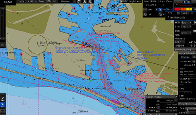
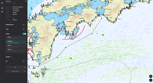
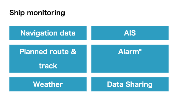
Ship Monitoring Service
*1: The information that can be monitored varies according to t he configuration of the equipment that are installed. However, the service is partially available with JRC equipment only.
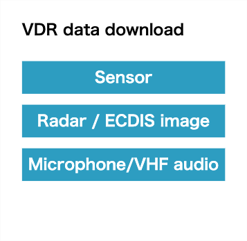
VDR Data Download Service
*2: To use this service, JCY-1900 or S-VDR JCY-1950 is required.
*3: Dedicated software of JRC, attached to VDR/S-VDR as the standard, Please contact us.

Data Sharing Service
*1: The information that can be monitored varies according to t he configuration of the equipment that are installed. However, the service is partially available with JRC equipment only.
Service contract is required in advance to start this service
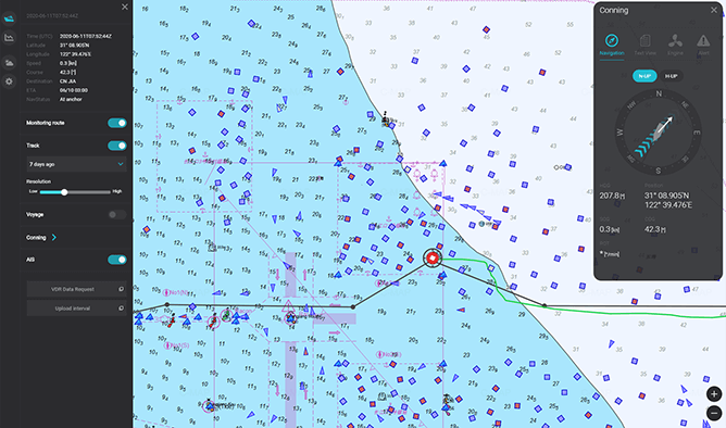
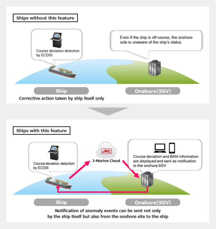
Course Deviation Monitoring Feature
In the past, the on-board ECDIS (Electronic Chart Display and Information System) was the only way to confirm if a ship was off course and to receive other alerts, but this new feature can be used to confirm the ship status even from the onshore side (SSV Mobile or SSV display screen). In the event of an anomaly, the ship can be contacted from the onshore side immediately, thereby helping to prevent accidents and respond quickly to other issues.
Decision Method
This is Recommended when you want to strictly control and be notified of any signs of course deviation. A cloud server calculates whether the current position of the ship (GPS position information) that is uploaded to the cloud is outside the preset route width. The route width can also be set by the onshore side operator, which is recommended when you want to strictly control and be notified of any signs of course deviation.
2. BAM Information-based Detection
This is also recommended when you want this information together with depth alerts and the other data shown in the following table. This is detection based on the cross track information from the ECDIS that is contained in the BAM (Bridge Alert Management) information, and this is also recommended when you want this information together with depth alerts and the other data shown in the following table.
| Target Alert Name | Old BAM Information | New BAM Information |
|---|---|---|
| Cross Track | Cross Track(Dev Ex) |
|
| Depth Alert |
|
Depth Alert |
| Crossing Safety Contour | Crossing Safety Contour | Crossing Safety Contour |
| Crossing a User Define Caution Object | Crossing a User Define Caution Object | Caution Symbol |
| Crossing a User define Warning Object | Crossing a User define Warning Object | Caution Symbol |
| Crossing a User define Alarm Object | Crossing a User define Alarm Object | Alarm Symbol |
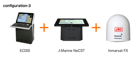
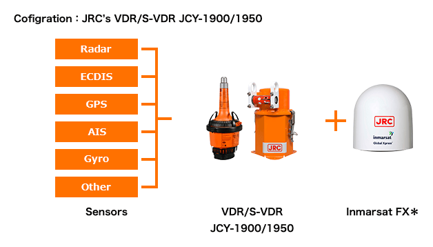
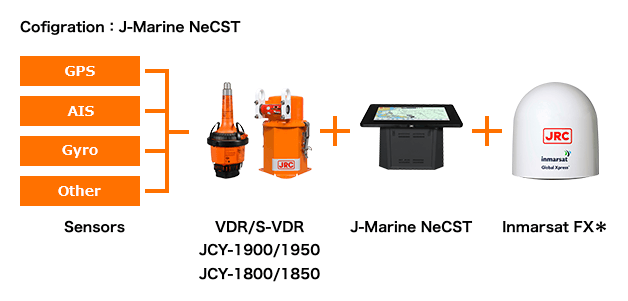
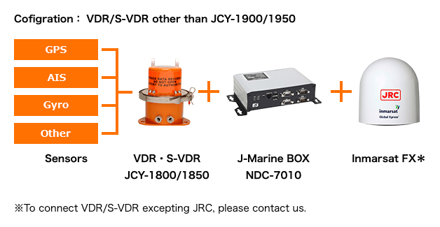
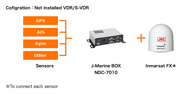
Examples of equipment configurations
| Examples of ship-side equipment configurations | Decision Method |
|---|---|
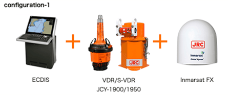 |
Supports both cloud-based detection and BAM information-based detection. |
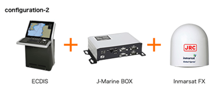 |
Only cloud-based detection is available for configurations 2 and 3. If your ships are installed a VDR made by another company, you can add JRC's J-Marine BOX or J-Marine NeCST made by JRC to enable support for cloud-based detection. |
 |
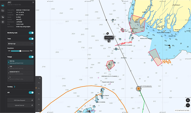
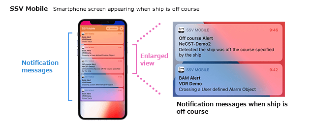
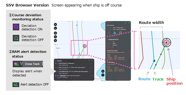
Examples of SSV Mobile and SSV Display Screens
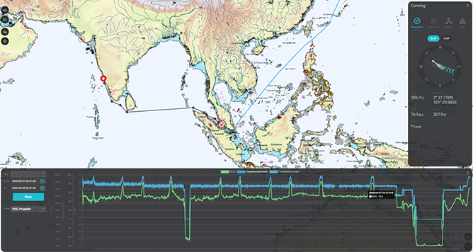
Distance and Other Measurement Features
Three new features for managing the ship on the map are now available: measuring the distance and bearing between two points on the map, measuring the area and perimeter distance of a specified area on the map, and measuring the distance like an EBL and VRM. These features can be used to check the distance from the shoreline or other ships when the onshore side operator is monitoring the status, contributing to hazard prediction.
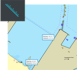
Bearing and Distance Measurement
Measures and displays the bearing and distance between two points on the map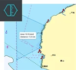
Area and Perimeter Distance Measurement
Measures and displays the area and perimeter distance of a specified area on the map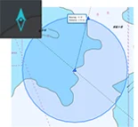
EBL and VRM Measurement
Measures and displays the bearing and distance of an image on the radar screen*EBL (Electronic Bearing Line): Used to measure the bearing to a target object.
*VRM (Variable Range Marker): Used to measure the exact distance to a target object.
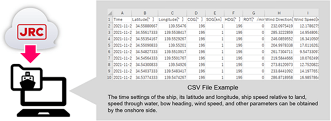
Data Download Feature
The sensor information of each ship that is stored in the cloud can be downloaded in CSV format. This feature contributes to situational analysis, such as factor investigation, in the event of an accident.
Playback feature
Expanded functions(Implemented in April 2022)
The camera frame can now be zoomed in and out. In addition to the conventional features of displaying camera images and the ship's position and track, this feature also enables playback of AIS and sensor information acquired by the ship.
Information distribution feature
Expanded functions(Implemented in April 2022)
When distributing information, this feature enables selection of the receiver and also checking of the estimated time required for distribution to each ship before starting distribution. This also enables the user to adjust when information will be distributed. It is also possible to check the distribution history and distribution status.
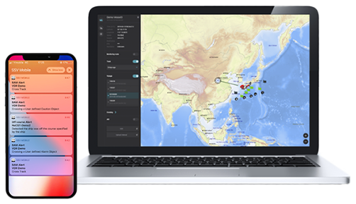
SSV Mobile
Obtain and Share Operation Status and Emergency Information of the Ship from Your Smartphone
In addition, the SSV Mobile integrates with the Emergency function of our J-Marine NeCST installed on the ship. This enables rapid notification of emergencies directly to your smartphone, allowing for a swift response via direct messaging with the ship.

Function
Fleet Viewer: Displays all managed ships on the map, with routes, tracks and AIS data.
Conning Display: Provides a view of sensor data and alerts, uploaded directly from the ship.
Weather & Oceanographic: Exhibits weather and oceanographic information.
Notifications History: Shows alert and emergency information, including chat history.
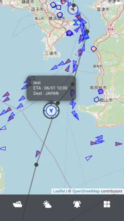
Fleet Viewe
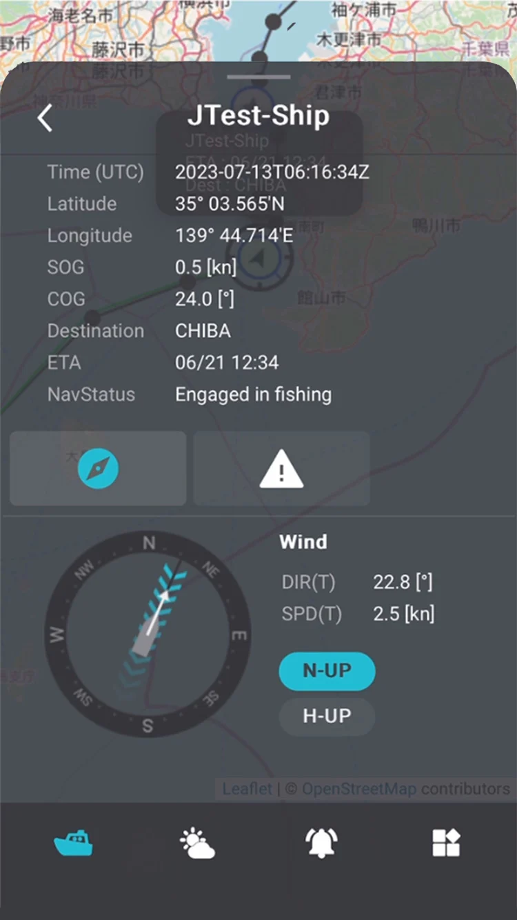
Conning Display
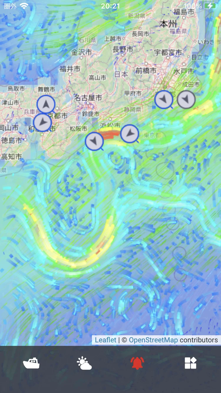
Weather & Oceanographic
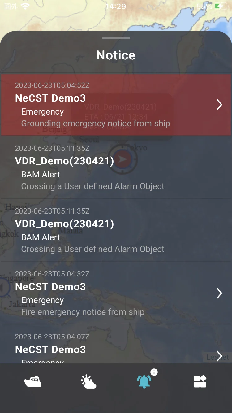
Notifications History
iOS

Apple, the Apple logo, iPad, and iPhone are Apple Inc.'s trademarks registered in the United States and elsewhere.
App Store is Apple Inc.'s service mark.
QR Code is Denso Wave Inc.'s registered trademark. Catal
System Configuration
Ship
| Example of equipment configuration | Product page |
|---|---|
 |
|
| Example of equipment configuration | Product page |
|---|---|
 |
|
| Example of equipment configuration | Product page |
|---|---|
 |
|
| Example of equipment configuration | Product page |
|---|---|
 |
Shore
Fleet Viewer
List of services
*Supporting with the new BAM (IEC 62923-1/-2) standard
Smart Ship Viewer/J-Marine BOX
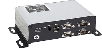
J-Marine BOX
This box is to get and send data from connecting navigation sensors to J-Marine Cloud for the ships installing VDRs excepting JCY-1900/1950.